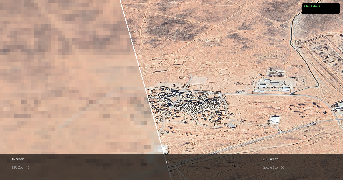
The Satellite Tile Hunt: From 15m Blobs to 13cm Resolution in an Air-Gapped Simulation
A practical guide to finding, downloading, and fusing satellite imagery and elevation data for an air-gapped Unity simulation. Covers every free tile provider (ESRI, Bing, Google), every free DTM source (SRTM, Copernicus, Mapzen), how to stitch thousands of tiles into Unity-ready textures, and the dead ends along the way.